
Durango Bill's
Grand Canyon 3-D Tour
Boysag Point to Havasu Creek and S B Point
Grand Canyon Miles 152 to 160
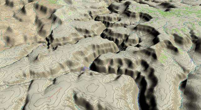
View to the
west-southwest with Sinyala Canyon in the lower left corner and
Havasu Canyon above it. Mt. Sinyala is an isolated remnant of
the South Rim, and can be seen between the two canyons. To the
north (right) of the Colorado River, Boysag Point (foreground)
and S B Point (near top edge) are part of the North Rim.
The river continues in a narrow gorge. The Bright Angel Shale remains below river level and thus the massive Redwall/Muav Limestone cliff rises straight up from the edge of the river. The large flat area is the Esplanade, which separates the deep inner gorge and the outer rims.
Here in the western part of the Grand Canyon the Watahomigi Formation, the lowest member of Supai Group, forms a distinct slope in-between the Supai’s upper layers and the underlying sheer cliff of the Redwall/Muav limestones.
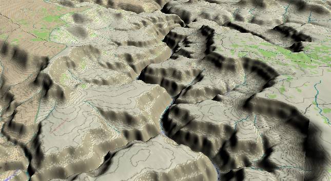
View to the
west-southwest with Havasu Creek in the lower left corner
and Yumtheska Point (South Rim) on the left edge. The North
Rim is on the right side of the picture with S B Point
extending off into the distance.
Havasu Creek is another popular hike for rafting groups. The canyon itself is somewhat like a green oasis sandwiched between vertical cliffs. Havasu Creek is usually a light blue color due to dissolved limestone.
Return to river miles 144 to 152
Continue to river miles 160 to 168
Return to the Index Page for the Grand Canyon Tour
Web page generated via Sea Monkey's Composer HTML editor
within a Linux Cinnamon Mint 18 operating system.
(Goodbye Microsoft)