
Durango Bill's
Paleogeography (Historical Geology) Research
Grand
Canyon
Maps
3-D Views of Northwestern
Arizona and the Grand Canyon Area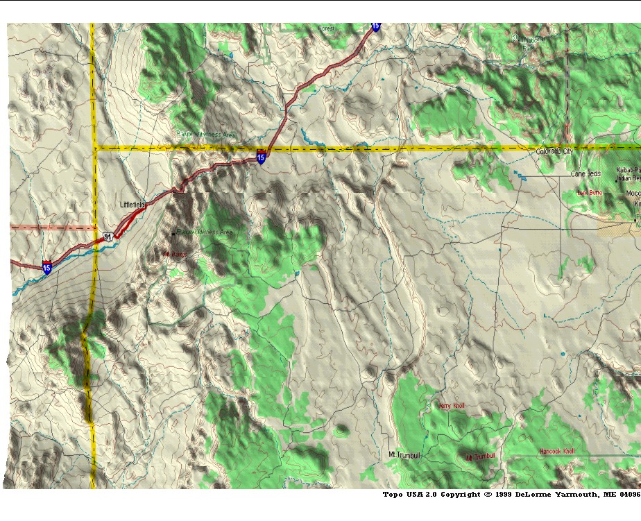
Contour intervals are 250
feet. (Click on any map to enlarge.)
Use "Back" from your browser to return to this page.
Use "Back" from your browser to return to this page.
The upper left map
shows the northwest corner of Arizona with highway I-15
running from Nevada northeastward to Zion National Park. The
north to south Grand Wash Cliffs are just east of the
Nevada/Arizona border while the north to south Hurricane
Cliffs are in the center of the picture.
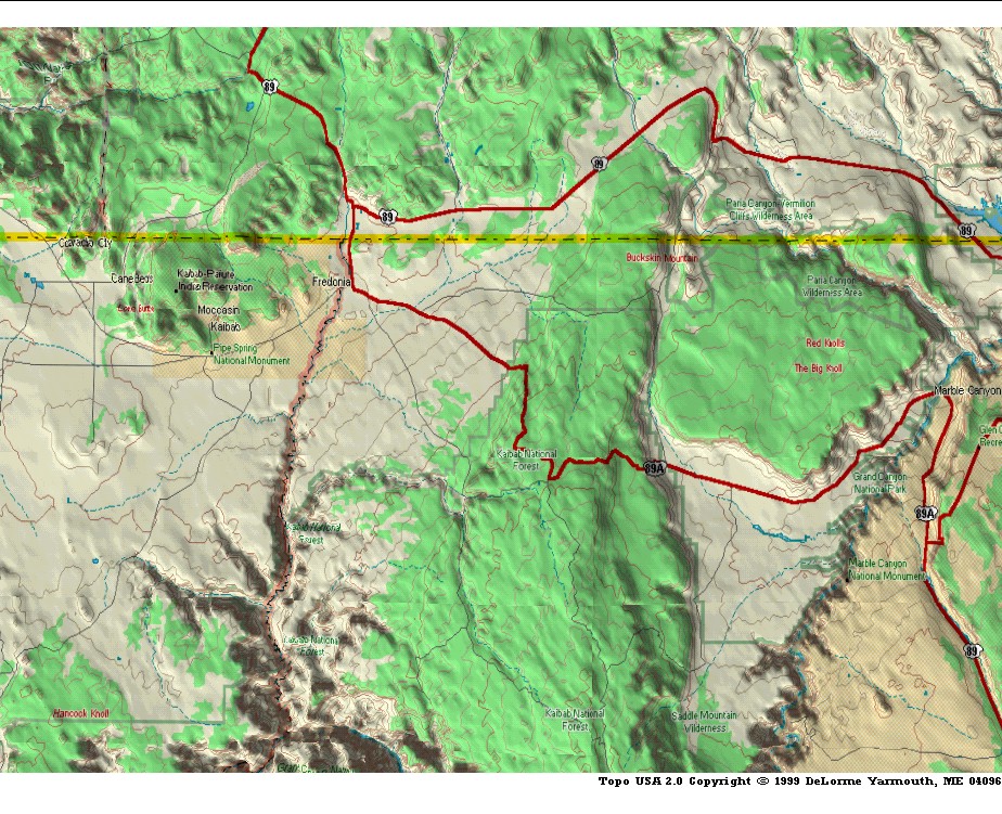
The upper right map shows Kanab Creek, the north end of the Kaibab Plateau, and the Marble Canyon section of the Grand Canyon (extreme right edge). A small corner of Lake Powell is also visible.
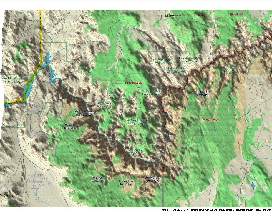
The lower left map shows the western portion of the Grand Canyon which ends abruptly at the Grand Wash Cliffs. The extreme eastern end of Lake Mead is at the left edge.
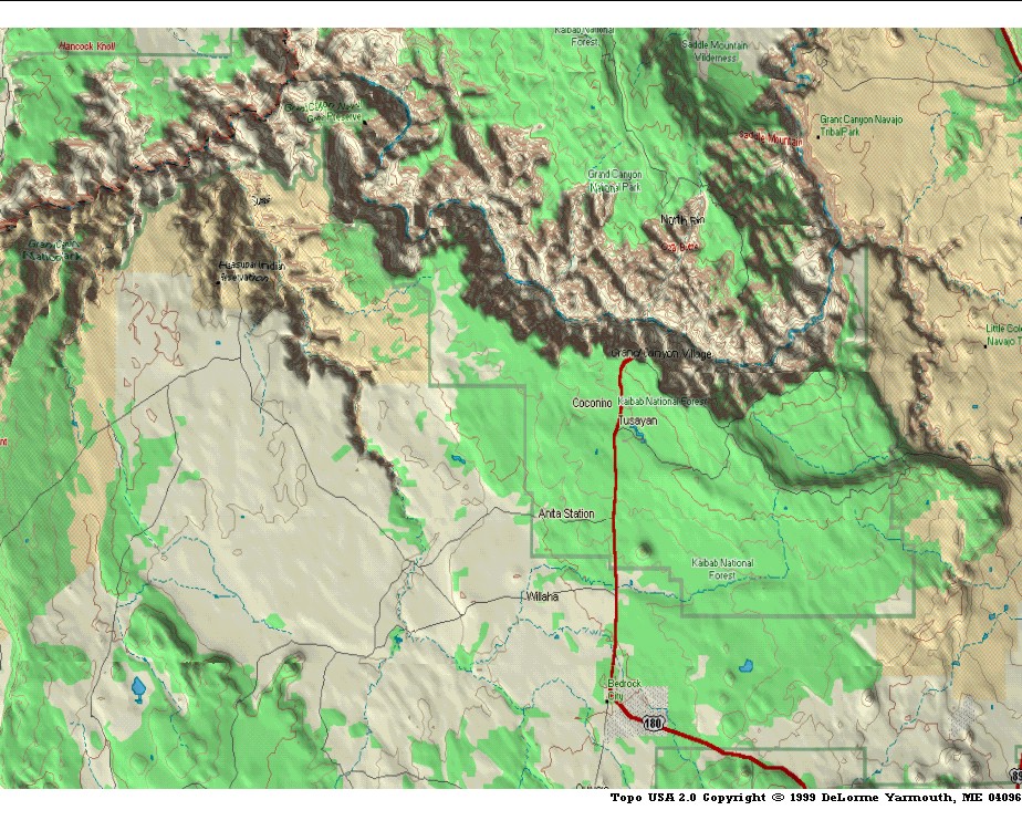
The lower right map shows the south rim of the Grand Canyon and the south end of the Kaibab Plateau. The prominent tributary left of center is Havasu Creek while the Little Colorado River enters from the right edge.
Return to the Image Index Page
Web page generated via Sea Monkey's Composer HTML editor
within a Linux Cinnamon Mint 18 operating system.
(Goodbye Microsoft)
The upper right map shows Kanab Creek, the north end of the Kaibab Plateau, and the Marble Canyon section of the Grand Canyon (extreme right edge). A small corner of Lake Powell is also visible.
The lower left map shows the western portion of the Grand Canyon which ends abruptly at the Grand Wash Cliffs. The extreme eastern end of Lake Mead is at the left edge.
The lower right map shows the south rim of the Grand Canyon and the south end of the Kaibab Plateau. The prominent tributary left of center is Havasu Creek while the Little Colorado River enters from the right edge.
Return to the Image Index Page
Web page generated via Sea Monkey's Composer HTML editor
within a Linux Cinnamon Mint 18 operating system.
(Goodbye Microsoft)