
Durango Bill's
Paleogeography (Historical Geology) Research
Cenozoic Rivers (of the ancestral Colorado River)
(Paleocene, Eocene, Oligocene, Miocene)
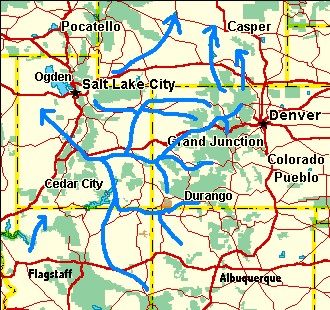
The maps below show
the evolution of river systems starting with the Late
Cretaceous/Paleocene through the late Miocene (just before the
Grand Canyon event). River positions were drawn free hand with
a mouse and are thus subject to some drawing error as well as
geologic uncertainties. However, the overall pattern is a
reasonably accurate depiction of the Evolution of the Colorado
River.
The maps were generated with Delorme's TopoUSA program. The usual credit notice was chopped off when pictures were edited to fit this page.
Return to the Evolution of the Colorado River page.
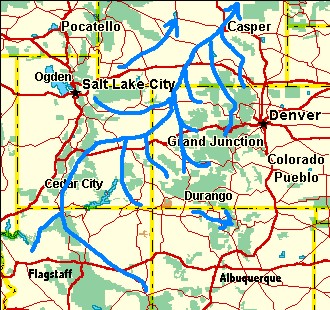
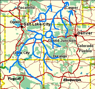
Late Cretaceous to Paleocene Eocene
(About 60 - 70 million years ago) (About 45 - 50 million years ago.)
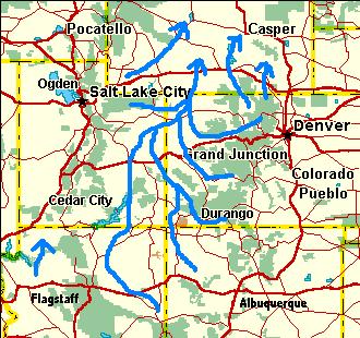
Oligocene
(About 30 million years ago)
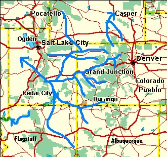
Early Miocene Late Miocene
(About 20 million years ago) (About 6 million years ago)
Web page generated via Sea Monkey's Composer HTML editor
within a Linux Cinnamon Mint 18 operating system.
(Goodbye Microsoft)
The maps were generated with Delorme's TopoUSA program. The usual credit notice was chopped off when pictures were edited to fit this page.
Return to the Evolution of the Colorado River page.
Late Cretaceous to Paleocene Eocene
(About 60 - 70 million years ago) (About 45 - 50 million years ago.)
Oligocene
(About 30 million years ago)
Early Miocene Late Miocene
(About 20 million years ago) (About 6 million years ago)
Web page generated via Sea Monkey's Composer HTML editor
within a Linux Cinnamon Mint 18 operating system.
(Goodbye Microsoft)